[[{"type":"media","view_mode":"media_large","fid":"219725","attributes":{"class":"media-image mt-image-none","typeof":"foaf:Image","style":"","width":"450","height":"276","alt":"F7412.jpg"}}]]
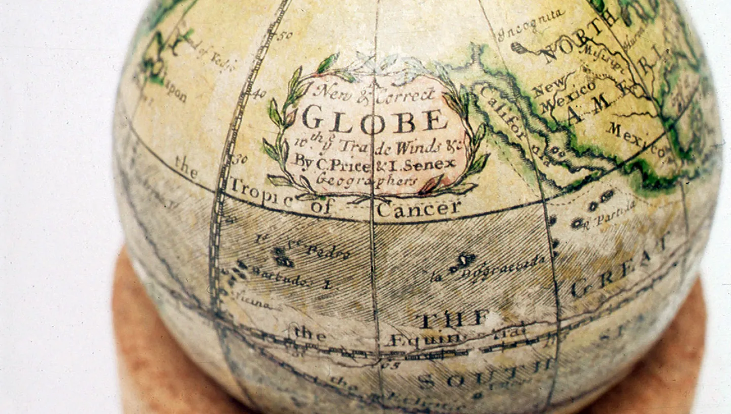
Map of North America by Herman Moll, circa 1712 (DUF292:2/2)
One of the really special things about working in a historical museum, like NMM, is the way that collections can focus your attention in different ways. We have so many items and objects on display here that I am yet to look at in great depth. This is in spite of the fact that I have walked through the galleries almost every day for the last three years. This week my attention was drawn to this map. It is something that I have never stopped at before - even though it is on one of my regular routes through the museum.
Our next exhibition, as part of the 'New Visions' programme of contemporary art, will be with the artist Renée Green, opening in January next year. Renée is currently developing a newly commissioned artwork that will explore ideas of islands, focusing in particular on the islands of Manhattan, Majorca and California. Yes, California. Today we understand this location as a state, but for many years westerners viewed this area of land as an island. Renée is based in New York and San Francisco and this week she visited London to start working on the installation of her new exhibition. On Friday, while we were wandering around the galleries, she espied a map on display in our 'Atlantic Worlds' exhibition that clearly describes California as an island. This map of North America was published around 1712 by the Dutch map publisher and engraver Herman Moll (1654-1732). Moll moved to London in 1678, where he became one of the most prominent map publishers in the country.
The myth of California being an island is difficult to trace, especially as earlier maps than this show it as a peninsula. For around one hundred years it became an island - perhaps the characteristic fog of San Francisco created the idea. However, in 1747, Ferdinand VII of Spain issued a royal edict that put a stop to this idea, declaring California as part of the mainland, and soon after it became firmly documented as a part of the larger continent. In Moll's map here, the strait described as 'Gulf of California or Red Sea' separates California from the mainland - a place where New Mexico is bordered by the mysterious 'Parts Unknown'.
Maps are inherently metaphorical as they cannot accurately represent or duplicate any place - they are fictions requiring interpretation. These maps in our collection, which we now know to be erroneous, are endlessly fascinating as they reveal belief systems from another time. These uncertainties are always interesting, indeed Lawrence Weiner, an artist who worked with us in 2007, has described the artist as a voyager who explores uncertainty and then tells others about it. This map makes me wonder how I might understand California - the Sunshine State that has filled so many fictions, films and pop songs - in a different way were it to be freed from its surrounding land.